Now taking early inquiries. Services are planned to begin in 2027; aerial work starts once pilot certification, insurance and equipment are in place. Tell us what you’d like to see
Agriculture · Gravel pits · Working sites

See the field first. Then decide what to do about it.

Drone mapping, targeted application, stockpile measurement and rugged connectivity for farms, gravel pits and other working sites. Every job starts with a question and ends with a decision you can act on.

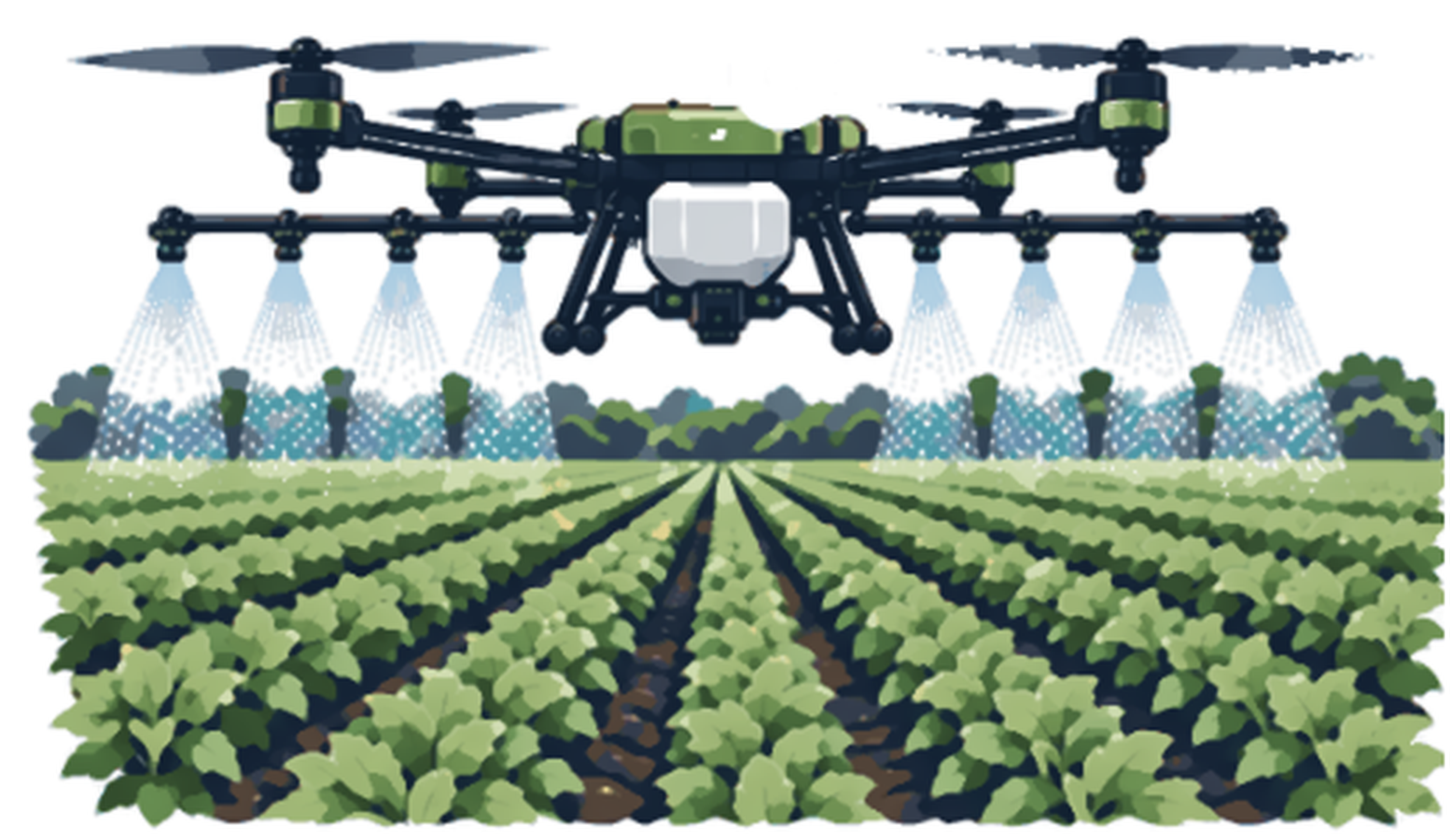
Illustration of an agricultural drone spraying a row crop fieldPrecision Aerial services ↓
Status: Precision Aerial is a planned offering, expected to begin in 2027. It starts once pilot certification, insurance and equipment are in place. Agricultural application also requires FAA authorization and state licensing, and will not be offered until those are in place.
Where growers and site owners start

Which of these sounds like you?

Part of the field looks wrong

Uneven color, thin stand, or yellowing. Mapping shows where, so scouting can find out why.

Wet fields, narrow window

Heavy equipment can’t enter without rutting. Some tasks can be done from the field edge.

A pit or yard to measure

Stockpile volumes, pit progress and haul-road conditions, tracked flight to flight instead of estimated by eye.

Agriculture

Mapping and targeted work for growers

01

Crop intelligence: RGB & multispectral mapping

The problem

Visible color alone may not show how variable a field is, and walking every acre to find a problem area costs time you don’t have.

How it helps you

Drone pictures show which parts of your field are struggling, so you check the right spots instead of walking every acre.

  • In-season scouting
  • Emergence review
  • Targeted follow-up

How we solve it

  1. Define the questionWhat does the grower need to decide: replant, scout, adjust irrigation, plan a treatment?
  2. Fly a repeatable patternRGB imagery for a clear field picture, and multispectral where suitable, planned for consistent overlap and timing so flights can be compared.
  3. Process the mapsGeoreferenced orthomosaics and vegetation-index layers such as NDVI or NDRE, compared across the field.
  4. Mark places to checkLocations flagged with GPS points for ground scouting, soil or tissue sampling, or an agronomist’s review.

What you receive

  • High-resolution field map
  • Index and variability maps
  • GPS locations for follow-up
  • A short scouting summary

Worth knowing: imagery shows patterns, not causes. Nutrient stress, pests, disease and moisture stress can look alike from the air, so ground verification matters.

02

Management zones & prescription mapping

The problem

A flat-rate treatment across the whole field can waste product when only some zones need attention.

How it helps you

Maps that show where a field needs more or less, so you don’t treat everything the same.

  • Variable-rate planning
  • Targeted application decisions
Agricultural spray drone in flight over a fieldPhoto: Blervis · CC0

How we solve it

  1. Combine the evidenceMapped variability plus what scouting and sampling found on the ground.
  2. Draw proposed zonesZones drawn with the grower or adviser, not decided by software alone.
  3. Prepare the exportWhere appropriate, a zone map or prescription file in a compatible format.
  4. Validate the decisionRates and products are confirmed by the grower’s agronomist and the product label.

What you receive

  • Zone map
  • Prescription export where compatible
  • Notes on the evidence behind each zone

Prescription rates and product choices require agronomic and label review. Not every anomaly calls for a spray.

03

Aerial liquid application

The problem

Wet ground, tight boundaries and small zones can make ground application difficult or damaging.

How it helps you

Liquid products applied from the air, even where the ground is too wet for equipment, once the required approvals are in place.

  • Liquid nutrients
  • Other legally permitted materials
Agricultural drone applying liquid over a cropPhoto: Shreesha Sharma · CC BY-SA 4.0

How we solve it

  1. Review product and labelCompatibility, rate, buffers and restrictions are confirmed before any flight is planned.
  2. Plan the missionBoundaries, no-spray areas, volume, weather limits and loading position.
  3. Apply and recordFlown with an agricultural drone, with flight logs showing where product was applied.
  4. Verify afterwardFollow-up imagery or scouting to see how the field responded.

What you receive

  • Written application plan
  • Coverage records
  • Follow-up comparison

Status: pesticide application is not currently offered. It would require FAA and state approvals, certifications, licensing and insurance first.

04

Granular application & aerial seeding

The problem

Dry materials and seed need accurate staging, rate control and controlled spreading, and fields aren’t always accessible.

How it helps you

Seed or dry products spread from the air without driving over your field, once any required approvals are in place.

  • Cover crops
  • Selected forage and specialty seed
  • Selected dry fertilizer

How we solve it

  1. Check the productDensity, particle size and seed fragility decide whether it spreads well from the air.
  2. Calibrate the rate and swathFlow rate and spread pattern tested before the job starts.
  3. Stage safelyBulk bags stay on the ground. The aircraft is loaded from a safe position at the field edge.
  4. Record what was appliedApplied-acre records tied to the flight logs.

What you receive

  • Distribution or seeding plan
  • Application area and rate records

Worth knowing: broadcast seeding is not the same as drilled seed. Establishment depends on soil contact, moisture, timing and weather, and we will tell you if a plan looks risky.

05

Wet-ground & muck-field operations

The problem

Saturated fields and muck soils can’t take wheeled equipment without rutting, and the agronomic window is short.

How it helps you

Get work done in the short window when fields are too soft for heavy equipment.

  • Michigan muck fields
  • Small irregular specialty parcels
  • Wet fields in narrow windows

How we solve it

  1. Assess accessWeather, soil conditions, field boundaries and where the aircraft can be launched and loaded.
  2. Choose what makes senseMapping, seeding or an eligible application, staged from firm ground.
  3. Plan around the windowFlight timing tied to crop stage and forecast.

What you receive

  • Field-access plan for the task
  • Mission plan matched to soft ground and boundaries
06

Thermal & infrastructure inspection

The problem

Some problems, such as irrigation issues, solar array faults or building heat loss, show up as temperature differences first.

How it helps you

Heat pictures that point to leaks, failing equipment or irrigation problems you can’t see.

  • Irrigation screening
  • Solar arrays
  • Building envelopes
  • Farm infrastructure

How we solve it

  1. Pick the right conditionsTiming and weather that make thermal data meaningful.
  2. Capture thermal and visible togetherVisible images give context to each thermal reading.
  3. Mark the anomaliesLocations flagged for close inspection.
  4. Recommend the next stepQualified trades or agronomists verify before repairs are recommended.

What you receive

  • Annotated thermal and visible images
  • List of locations to inspect

Worth knowing: a hot spot doesn’t prove an electrical fault, a leak or a disease. It tells you where to look.

Gravel pits & working sites

Measure what is on the ground and how it changes

07

Gravel pit & stockpile mapping

The problem

Stockpile quantities, pit extents and haul-road conditions are hard to track from the ground, and calling a surveyor for every question is slow and costly.

How it helps you

Know how much material is in each pile and how your pit is changing, without climbing the piles with a tape measure.

  • Gravel pits
  • Aggregate and sand yards
  • Topsoil and landscape suppliers
  • Earthmoving operations

How we solve it

  1. Agree how you will measureWhich base surface to use, which control points to set, and the accuracy you need. This decides the method and the price.
  2. Fly the pit on a repeatable planThe same flight pattern each visit, with overlap and ground control so results compare cleanly from month to month.
  3. Build surface models and volumesOrthomosaic and elevation model, pile outlines drawn, volumes calculated against the agreed base with the assumptions written down.
  4. Compare visitsCut and fill, stockpile movement, and changes along haul roads, ramps and drainage between flights.
  5. Flag what needs attentionStanding water, rutted haul roads, unstable faces and encroachment, marked on the map for follow-up.

What you receive

  • Volume report with stated assumptions
  • Mapped pile and pit outlines
  • Elevation model and visit-to-visit comparison
  • Annotated notes on haul roads and drainage

Worth knowing: volumes are approximate and depend on the base surface and control you choose. They are not a licensed survey. If a number goes to a regulator, lender or royalty payment, your surveyor should confirm it, and we can supply data in formats they use.

08

Construction & land mapping

The problem

Project teams and landowners need an up-to-date picture for planning, communication and records.

How it helps you

An up-to-date overhead picture of your site to share with your crew, customers or contractors.

  • Construction progress
  • Drainage and terrain documentation
  • Land management
  • Property records

How we solve it

  1. Agree on accuracyThe accuracy you need decides the capture method, ground control and processing.
  2. Capture with overlapOverlapping images flown in a planned pattern.
  3. Process and annotateOrthomosaic and elevation models, with features of interest marked.
  4. Compare over timeRepeat flights from the same plan show change between visits.

What you receive

  • Georeferenced site imagery
  • Annotated maps
  • Date-stamped comparison views

Worth knowing: these maps are not a licensed boundary survey or engineering design.

Connected operations

Technology between the fields, shops and pits

09

Connected farms & sites

The problem

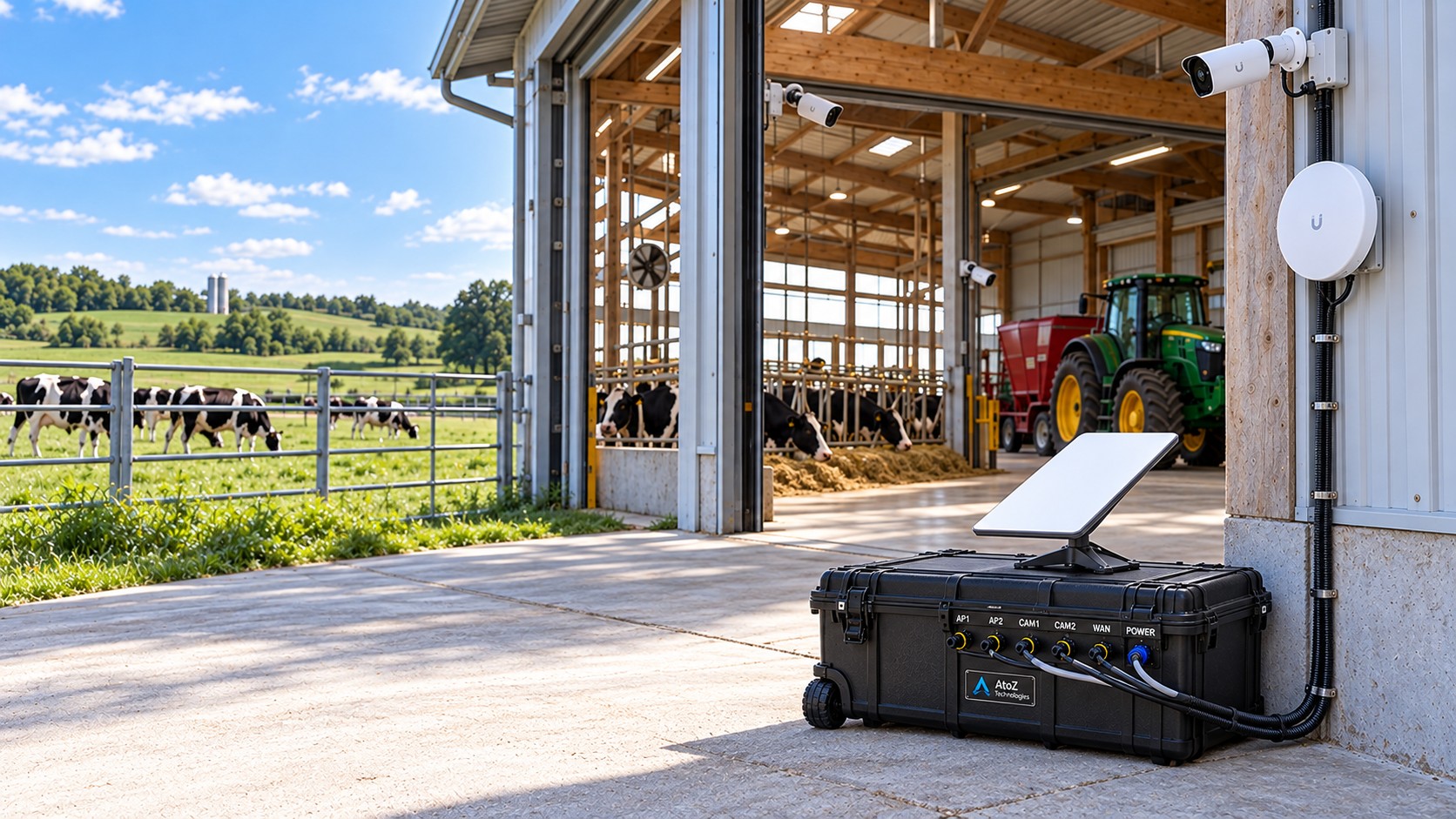
Shops, barns, grain bins, irrigation pumps, gates and pits are spread out, with weak or no Wi-Fi between them, so cameras and remote checks stop working where you need them most.

How it helps you

Wi-Fi, cameras and alerts across your barns, shops and pits so you can check on things from your phone.

  • Farms and orchards
  • Gravel pits and equipment yards
  • Rural shops and storage
Portable network case with satellite dish connecting cameras and a Wi-Fi link at a dairy farm barnConcept image. A photo of our own work will replace it.

How we solve it

  1. Map what needs to be reachedBuildings, equipment yards, pumps, gates and pits, with distances and power available at each.
  2. Link the locationsPoint-to-point wireless, outdoor Wi-Fi or fiber where it makes sense, planned around terrain, trees and buildings.
  3. Add cameras and visibilityCameras on gates, equipment yards, bins and pit entrances, with recording and access for the people who need it.
  4. Keep it poweredBattery backup and surge protection at every remote point, and solar where there is no line power and it is suitable.
  5. Set up remote checks and supportAlerts for a dropped link or a dead camera, and a clear way to get help when something stops working.

What you receive

  • Connectivity plan and site map
  • Installed links with measured performance
  • Camera views and recording settings
  • Remote access and alert setup

Worth knowing: connecting sensors, irrigation controllers or scales depends on what your equipment supports. We confirm compatibility before we quote. Built on our mobile networking work.

Planning

Putting it on a calendar and a budget

10

Pricing & seasonal programs

The problem

Growers want a price per acre, but spreading 2 gallons of liquid per acre and spreading 100 pounds of fertilizer per acre are very different jobs, with very different costs.

How it helps you

A season plan with set dates and a written price, so you know what to expect.

  • One-off flights
  • Seasonal programs
  • Small parcels

How we solve it

  1. Start with the product and the rateHow much goes on each acre decides how many trips the aircraft makes, how often it reloads, and how long the job takes. Light liquid rates cost less per acre than heavy dry rates.
  2. Add field size and distanceAcres, the number of fields, how far apart they are, and our travel to reach them.
  3. Add what you want to learnMapping is priced per acre and depends on the type of map and how many visits you want across the season.
  4. Quote it in writingYou get a per-acre price or range, plus what is and isn’t included, before any work is scheduled.
  5. Plan the season if you likeRepeat mapping visits and any application work can be set on a calendar with a single written plan.

What you receive

  • A written per-acre price or range for your product and rate
  • A season calendar if you want one
  • A clear list of what is included and what is extra

We don’t publish one flat per-acre number because it would be wrong for most jobs. Tell us the product and rate, or ask us to help you work them out.

For growers

From a field problem to a decision

This is how a typical question moves from imagery to action. Imagery points; people confirm; then you decide.

The problemInvestigateConfirmAct and verify
Uneven growth or yellowingMultispectral vigor maps with RGB for context show where plants differ.Scout the zones. Compare soil or tissue samples, field history and an agronomist’s view.Where it’s justified, consider targeted nutrition. Revisit with comparable imagery.
Wet ground, limited machinery accessRGB mapping documents boundaries, access and wet areas.Check whether aerial work is suitable given buffers, wind and product restrictions.Complete an authorized mission without driving heavy equipment across sensitive areas.
Patchy emergence or stand gapsRGB imagery and ground counts quantify affected areas.Separate emergence problems from soil, pest or weather damage.Discuss reseeding or other options when agronomically and economically justified.
Stockpile or pit volume questionOverlapping imagery builds a surface model of the pile or pit.Check the result against scale tickets or a surveyor’s control points.Update inventory, plan hauling or excavation, and repeat flights to track change.
Suspected irrigation or drainage issueThermal and multispectral patterns can show uneven moisture or crop response.Inspect equipment, soil moisture and drainage.Repair or adjust irrigation. Spraying isn’t necessarily the answer.
Equipment

Aircraft we plan to use

We choose the aircraft for the job, not the other way around. These are the platforms we’re evaluating and planning around. They are planning examples, not claims of ownership or inventory.

DJI Agras T100

Application & lifting

Evaluated as the primary application aircraft. Liquid, granular and lifting are separate configurations, not simultaneous payloads. Subject to U.S. availability, dealer support and certifications.

DJI Mavic 3 Multispectral

Crop mapping

RGB plus dedicated spectral bands for vegetation indices and repeatable georeferenced crop-vigor maps.

DJI Matrice 4E

RGB mapping & survey

A newer enterprise mapping candidate for field orthomosaics, site documentation and progress comparison. Accuracy depends on RTK or ground-control strategy.

DJI Matrice 4T

Thermal inspection

A thermal-capable platform for irrigation screening, building envelopes, solar assets and equipment hot spots.

Regulation: aerial dispensing, pesticide application and other regulated activities are subject to FAA, state and other applicable approvals. Lifting capacity published by a manufacturer is not a promise of permissible payload or authorization; every mission is approved individually.
Questions

Straight answers.

Can a multispectral map tell me what’s wrong with a crop?

It shows patterns of variability. The cause has to be investigated with field observations and appropriate agronomic expertise.

Can you spray pesticides?

Not currently. Any future pesticide offering depends on FAA and state approvals, certification, business licensing and insurance.

Does aerial seeding guarantee establishment?

No. Seed selection, soil contact, moisture, timing and weather all affect emergence. We review suitability before proposing a mission.

Can you measure stockpiles at a gravel pit?

Yes. We build surface models and calculate approximate volumes against an agreed base, and repeat visits show change. Treat them as working numbers, not a licensed survey.

Are your maps legal surveys?

No. Orthomosaics and terrain visualizations do not replace a licensed land survey or engineering design.

How much per acre?

It depends on what is being applied. A light liquid rate of a couple of gallons per acre is a different job than spreading 100 pounds per acre of dry product. Tell us the product, rate and acreage and we’ll quote a per-acre price in writing. Mapping is quoted per acre by map type and number of visits.

Tell us what you’re trying to get done.

A short description is enough. We’ll reply with questions or a recommended next step, not a generic package.

Request a quote

or email [email protected] or call (989) 640-5963